Showing posts with label ruins. Show all posts

Friday, February 8, 2013

Mayan Ruins in the Yucatan at Chichen Itza

Mayan Ruins in the Yucatan at Chichen Itza


The prehistoric structures of Yucatan—among the principal of which are those of Uxmal and Chichen-Itza—are exceedingly numerous. Indeed, the traveller in this territory of the Mayas is rarely out of sight of crumbling pyramid or temple, as he traverses the dense forests of these curious flat and streamless limestone regions. Whilst most of these edifices were for purposes of religious ceremonial, the object of many of them can scarcely be conjectured. Their builders appear to have been people of a peaceful nature, and their dwellings do not generally bear evidence of defensive design. The architectural skill of the Mayas must have been of a very high order. Among the buildings which exist some are nearly perfect units of design, and seem almost to argue the use of "working drawings," as the plan and detail must have been perfected as a whole before the building was begun. This architectural skill of conception, however, has been common in many countries. Some of the buildings were in use when Cortes landed and fought on the shores of Yucatan, nearly four hundred years ago; nevertheless, they are in a remarkable state of preservation, notwithstanding the ravages both of Nature and of man, tending towards their destruction; for on the one hand, the roots of trees and profuse vegetation of a tropical region are efficient levers in the throwing down of the masonry, and on the other, the vandal ignorance of the surrounding inhabitants of the modern towns of the region permits them to make use of the stones in their own walls.


The ruins of Chichen-Ytza, the prehistoric city in the northern part of Yucatan, are among the most important and best preserved of any of the stone structures of the Americas. The ruins are grouped around two great natural wells, the cenotes, famous in this remarkable peninsula. Indeed, the derivation of the name of the old city is from Maya words meaning the "Mouth of the Well," and it serves to show the value in which these singular water-supplies were held in this riverless region of Yucatan. Among the most interesting of the structures of Chichen and Uxmal is that of the buildings known as El Foloc, or "the Church." Another is that known as the "House of the Nuns," and yet another the "Temple of the Tigers," which latter shows a sculptured procession of tigers or lynxes. Again, "the Castle" is remarkable, set upon a pyramid rising more than 100 feet above the plain. The "Governor's Palace," the "House of the Pigeons," and "House of the Turtles," are others of these remarkable structures.


The profuse and extraordinary, yet barbaric-appearing sculpture of the façades and interiors of these buildings arrests the observer's attention, and, indeed, fills him with amazement, as does their construction in general. What instruments of precision did a rude people possess who could raise such walls, angles, monoliths, true and plumb as the work of the mason of to-day?


It would be beyond the scope of this work to enter more fully into the details of these ruins. They have been minutely examined and described by famous archæologists, who have devoted much time thereto, and the student may be referred to their works. The foregoing is but a sketch, barely touching upon the extensive and beautiful handwork in stone of the ancient dwellers of this land. Indeed, the traveller may behold them for himself, without great risk or difficulty. He will observe them with admiration. Pyramids rising from the plains or forest-seas which surround them; strange halls where unknown people dwelt; great cities where busy races lived. The character of the various groups of ruins throughout the land shows the effect that the geology of the respective regions has had upon the stone-masonry of these prehistoric builders. As has been shown, the beautiful trachyte of Mitla, which, whilst it is tough and enduring, is soft, and lends itself readily to the chisel. The result has been handed down in the beautiful and exact sculpture of the blocks and grecques of the façades of these palaces: work which could not have been performed in a more refractory stone. Not a great distance away are the Monte Alban ruins, as described, which, although extensive and remarkable, show nothing of exact and intricate work in stone-shaping. The hard or silicious rocks which form the immediate region, and the quartzite and crystalline limestone, did not lend themselves, either in the quarry or under the chisel, to such work. In Chiapas, the unshaped and uncoursed masonry of Palenque is formed of a hard, brittle limestone, scarcely capable of being worked to faces. No invisible joints, such as are the beauty of some of the ancient stone structures of the Americas—North and South—were possible, and mortar and stucco were freely employed. Very different, however, was the limestone used in Yucatan. It was easily quarried from its bed, and was of such a texture as lent itself to the profuse and beautiful sculpture of those Maya cities of long ago. Again, the great pyramidal structures of Teotihuacan and surrounding ruins of the Toltec civilisation, had little for their composition but lavas of basaltic nature, which did not possess a character adaptable for exact stone-shaping. Thus it is seen how largely the existence, or non-existence, of freestone influenced the character of these prehistoric structures.

The Mayan Ruins at Palenque

The Mayan Ruins at Palenque


    The ruins of Palenque, in the State of Chiapas, are situated at the base of the picturesque foothills of Tumbala, which border upon Guatemala, in a true tropical environment of luxuriant forest and brimming streams. From this setting the ruined temples and pyramids stand forth like a vision of a charmed or fabled story. Dense tropical undergrowth covers them, and grows again as soon as explorers, who have removed portions of Nature's persistent covering, leave the place. The main structures take the form of great truncated pyramids built up of earth, stones, and masonry, with temples and palaces of masonry upon their summits. Twelve of these pyramids have been discovered so far, and eight are crowned by buildings, the principal of which are known respectively as, the "Temple of the Sun," the "Temple of the Cross," "Temple of the Inscriptions," and the extensive group of ruins termed "The Palace." These temples and palaces consist of massive masonry walls, partly of roughly-shaped blocks, and partly of cut-and-carved stone, and stucco sculpture, with numerous doorways or openings on to the platform of the pyramid-summit. The interior of the buildings is a singular vault-like construction, covered with roofs of masonry carried by the vaulting. These vaults, however, do not embody the principle of the arch, but rather of the off-set, or lean-to, and are very high in proportion to their width. From the palace group arises a square tower of four storeys, about 40 feet in height, forming the centre of the group of extensive courts, buildings, and façades which surround it, all built upon the summit of a pyramid some 200 feet square. As in the Yucatan structures, the lintels over the doorway-openings in the walls were of wood, and their decay has largely been the cause of the façades having fallen into ruins, in many places. There are various interior staircases to these buildings, and the huge and unique reliefs of human figures are a remarkable feature of the interior. The beautiful figure known as the Beau Relief is compared to the relief sculptures of Babylon and Egypt. The material of construction was limestone, generally in unshaped blocks, not laid in regular courses, but with large quantities of mortar and stucco. The walls were lavishly painted and coloured. Indeed, the nature of the building has doubtless obeyed the character of the stone, which does not lend itself to careful cutting and carving like the easily-worked trachyte of Mitla. A very noteworthy structure of this prehistoric city, is the subterranean passage-way for the stream, which passes down the valley upon whose slopes the ruins of Palenque are situated. This, of stone-vaulted construction, after the manner before described, is somewhat less than 1,000 feet long, and the stream still flows through a portion of it. On every hand the extraordinary vigour of the tropical forest is evident, and the dense growth of trees, vines, and herbs which cover valley, pyramid, walls, and roofs, attest the power of the vegetable world.

Tuesday, May 1, 2012

Mexico's Aztec Ruins at Mitla


MEXICAN MITLA AZTEC RUINS


The ruins called Mitla are in the Mexican State of Oxaca, about twelve leagues east from the city of Oxaca. They are situated in the upper part of a great valley, and surrounded by a waste, uncultivated region. At the time of the Spanish Conquest they were old and much worn by time and the elements, but a very large area was then covered by remains of ancient buildings. At present only six decaying edifices and three ruined pyramids, which were very finely terraced, remain for examination, the other structures being now reduced to the last stage[ of decay. Figures 30 and 31 present views of some of these structures, as given by Von Temski. Figure 32, from Charnay’s photograph, shows a ruin at Mitla.
Detail of buildingFig. 31.—Great Hall at Mitla.
These important ruins were not described by Stephens and Catherwood. Captain Dupaix’s work gives some account of them, and Desiré Charnay, who saw them since 1860, brought away photographs of some of the monuments. Four of the standing edifices are described by Dupaix as “palaces,” and these, he says, “were erected with lavish magnificence; * * * they combine the solidity of the works of Egypt with the elegance of those of Greece.” And he adds, “But what is most remarkable, interesting, and striking in these monuments, and which alone would be sufficient to give them the first[]
[


 rank among all known orders of architecture, is the execution of their mosaic recievos, very different from plain mosaic, and consequently requiring more ingenious combination and greater art and labor. They are inlaid on the surface of the wall, and their duration is owing to the method of fixing the prepared stones into the stone surface, which made their union with it perfect.” Figure 33, taken from Charnay’s photograph, shows part of the mosaic decoration on a wall of one of the great edifices at Mitla.
View of ruinsFig. 32.—Ruined Palace at Mitla.
Detail of architectural stone mosaic sculptureFig. 33.—Mosaics at Mitla.
The general character of the architecture and masonry is much like that seen in the structures at Palenque, but the finish of the workmanship appears to have been more artistic and admirable. These ruins are remarkable among those of the country where they are found. All who have seen them speak much as Dupaix speaks of the perfection of the masonry, the admirable design and finish of the work, and the beauty of the decorations. Their beauty, says M. Charnay, can be matched only by the monuments of Greece and Rome in their best days. One fact presented by some of the edifices at Mitla has a certain degree of historical significance. There appears to be evidence that they were occupied at some period by people less advanced in civilization than their builders. M. Charnay, describing one of them, points out this fact. He says of the structure:

“It is a bewildering maze of courts and buildings, with facings ornamented with mosaics in relief of the purest design; but under the projections are found traces of paintings wholly primitive in style, in which the right[ line is not even respected. These are rude figures of idols, and meandering lines that have no significance. Similar paintings appear, with the same imperfection, on every great edifice, in places which have allowed them shelter against the ravages of time. These rude designs, associated with palaces so correct in architecture, and so ornamented with panels of mosaic of such marvelous workmanship, put strange thoughts in the mind. To find the explanation of this phenomenon, must we not suppose these palaces were occupied by a race less advanced in civilization than their first builders?”
Two miles or more away from the great edifices here mentioned, toward the west, is the “Castle of Mitla.” It was built on the summit of an isolated and precipitous hill of rock, which is accessible only on the east side. The whole leveled summit of this hill is inclosed by a solid wall of hewn stone twenty-one feet thick and eighteen feet high. This wall has salient and retiring angles, with curtains interposed. On the east side it is flanked by double walls. Within the inclosure are the remains of several small buildings. The field of these ruins was very large three hundred years ago. At that time it may have included this castle.

Friday, March 30, 2012

New Mexico Indian Ruins


A VISIT
TO THE
ABORIGINAL RUINS
IN THE
VALLEY OF THE RIO PECOS.

II.

A VISIT TO THE  NEW MEXICO INDIAN ABORIGINAL RUINS IN THE
VALLEY OF THE RIO PECOS.
decorative line
About thirty miles to the south-east of the city of Santa Fé, and in the western sections of the district of San Miguel (New Mexico), the upper course of the Rio Pecos traverses a broad valley, extending in width from east to west about six or eight miles, and in length from north-west to south-east from twenty to twenty-five. Its boundaries are,—on the north and north-east, the Sierra de Santa Fé, and the Sierra de Santa Bárbara, or rather their southern spurs; on the west a highmesa or table land, extending nearly parallel to the river until opposite or south of the peak of Bernal; on the east, the Sierra de Tecolote. The altitude of this valley is on an average not less than six thousand three hundred feet, while themesa on the right bank of the river rises abruptly to nearly two thousand feet higher; the Tecolote chain is certainly not much lower, if any; and the summits of the high Sierras in the north rise to over ten thousand feet at least.p. 38
The Rio Pecos (which empties into the Rio Grande fully five degrees more to the south, in the State of Texas) hugs, in the upper part of the valley, closely to the mountains of Tecolote, and thence runs almost directly north and south. The highmesa opposite, known as the Mesa de Pecos, sweeps around in huge semicircles, but in a general direction from north-west to south-east. The upper part of the valley, therefore, forms a triangle, whose apex, at the south, would be near San José: whereas its base-line at the north might be indicated as from the Plaza de Pecos to Baughl's Sidings; or rather from the Rio Pecos, east of the town, to the foot of the mesa on the west, a length of over six miles. Nearly in the centre of this triangle, two miles west of the river, and one and a half miles from Baughl's, there rises a narrow, semicircular cliff ormesilla, over the bed of a stream known as the Arroyo de Pecos.] The southern end of this tabular cliff (its highest point as well as its most sunny slope) is covered with very extensive ruins, representing, as I shall hereafter explain, three distinct kinds of occupation of the place by man. These ruins are known under the name of the Old Pueblo of Pecos.
The tourist who, in order to reach Santa Fé from the north, takes the Atchison, Topeka & Santa Fé Railroad at La Junta, Colorado,—fascinated as he becomes by the beauty as well as by the novelty of the landscape, while running parallel with the great Sierra Madre, after he has traversed the Ratonis at daybreak,—enters a still more weird country in the afternoon. The Rio Pecos is crossed just beyond Bernal, and thence on he speeds towards the west and north: to the left, the towering Mesa de Pecos, darkp. 39 pines clambering up its steep sides; to the right, the broad valley, scooped out, so to say, between the mesa and the Tecolote ridge. It is dotted with green patches and black clusters of cedar and pine shooting out of the red and rocky soil. Scarcely a house is visible, for the casitas of adobe and wood nestle mostly in sheltered nooks. Beyond Baughl's, the ruins first strike his view; the red walls of the church stand boldly out on the barren mesilla; and to the north of it there are two low brown ridges, the remnants of the Indian houses. The bleak summits of the high northern chain seem to rise in height as he advances; even the distant Trout mountains (Sierra de la Trucha) loom up solemnly towards the head-waters of the Pecos. About Glorieta the vale disappears, and through the shaggy crests of the Cañon del Apache, which overlooks the track in awful proximity, he sallies out upon the central plain of northern New Mexico, six thousand eight hundred feet above the sea-level. To the south-west the picturesque Sandia mountains;[90] to the west, far off, the Heights of Jemez and the Sierra del Valle, bound the level and apparently barren table-land. An hour more of fearfully rapid transit with astonishing curves, and, at sunset, he lands at La Villa Real de Santa-Fé.
Starting back from Santa Fé towards Pecos on a dry, sandy wagon-road, we lose sight of the table-land and its environing mountain-chain, when turning into the ridges east of Manzanares. Vegetation, which has been remarkably stunted until now, improves in appearance. However rocky the slopes are, tall pines grow on them sparsely: the Encina appears inp. 40thickets; Opuntia arborescens bristles dangerously as a large shrub; mammillary cactuses hide in the sand; even an occasional patch of Indian corn is found in the valleys. It is stunted in growth,[91] flowering as late as the last days of the month of August, and poorly cultivated. The few adobe buildings are mostly recent. Over a high granitic ridge, grown over with piñon (all the trees inclined towards the north-east by the fierce winds that blow along its summit), and from which the Sierra de Sandia for the last time appears, we plunge into a deep valley, emptying into the Cañoncito, and thence follow the railroad track again through a deep gorge and pleasant bottom, overgrown with pines and cedars, past Glorieta to Baughl's.[92] It required all the skill and firmness of my friend and companion, Mr. J. D. C. Thurston, of the Indian Bureau at Santa Fé, to pilot our vehicle over the steep and rocky ledges. From Baughl's, where I took quarters at the temporary boarding-house of Mrs. Root (to whose kindness and motherly solicitude I owe a tribute of sincere gratitude), a good road leads to the east and south-east along the Arroyo de Pecos. In a direct line the distance p. 41to the ruins is but a mile and a half; but after nearing the banks of the stream (which there are grassy levels), one is kept at a distance from it by deep parallel gulches. So we have to follow the arroyo downwards, keeping about a quarter of a mile to the west of it, till, south of the old church itself, the road at last crosses the wide and gravelly bed, in which a fillet of clear water is running. Then we ascend a gradual slope of sandy and micaceous soil, thinly covered by tufts of grama; a wide, circular depression strikes our eye; beyond it flat mounds of scarcely 0.50 m.—20 in.—elevation are covered extensively with scattered and broken stones. Further on distinct foundations appear, rectangles enclosed by, or founded originally upon, thick walls of stone, sunk into the ground and much worn,—sometimes divided into small compartments, again forming large enclosures. To the south a conspicuous, though small, mound is visible. Immediately before us, due north, are distinct though broken walls of stones; and above them, on a broad terrace of red earth, completely shutting off the mesilla or tabulated cliff, on which the Indian houses stand, there arises the massive former Catholic temple of Pecos.
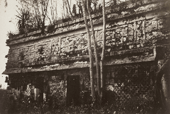
PLATE VI: VIEW OF CHURCH, FROM THE SOUTH.PLATE VI:
VIEW OF CHURCH, FROM THE SOUTH.
The building forms a rectangle, about 46 m.—150 ft.—long, from east to west, and 18 m.—60 ft.—from north to south. The entrance was to the west, the eastern wall being still solid and standing, Fig. 2, gives an idea of its form: á aare gateways, each capped by a heavy lintel of hewn cedar; b, carved beam of wood across.
The roof of the building is gone, and on the south side a part of the walls themselves are reduced to a few metres elevation. The church may originally have been not less than 10 m.—33 ft.—perhaps higher. It had, according to tradition, but one belfry and a single bell,—a very large one at that. The Indians carried it off, it is said, to the top of thep. 42 mesa, where it broke. It is certain that a very large bell, of which I saw one fragment, now in possession of Mr. E. K. Walters, of Pecos, was found on the western slope of the Mesa de Pecos, about three miles from its eastern rim, in a cañada of the Ojo de Vacas stream, towards San Cristóbal. Mr. Thomas Munn, of Baughl's, took the pains of piloting me a whole day (6th of September) through the wilderness of the mesa, and showing me the place where this interesting relic was finally deposited. I shall return to this by and by.
Mrs. Kozlowski (wife of a Polish gentleman, living two miles south on the arroyo) informed me that in 1858, when she came to her present home with her husband, the roof of the church was still in existence. Her husband tore it down, and used it for building out-houses; he also attempted to dig out the corner-stone, but failed. In general, the vandalism committed in this venerable relic of antiquity defies all description. It is only equalled by the foolishness of such as, having no other means to secure immortality, have cut out the ornaments from the sculptured beams in order to obtain a surface suitable to carve their euphonious names. All the beams of the old structure are quaintly, but still not tastelessly, carved; there was, as is shown in., much scroll-work terminating them. Most of this was taken away, chipped into uncouth boxes, and sold, to be scattered everywhere. Not content with this, treasure-hunters, inconsiderate amateurs, have recklessly and ruthlessly disturbed the abodes of the dead. "After becoming Christians," said to me Sr. Mariano Ruiz, the only remaining 'son of the tribe' of Pecos, still settled near to its site, "they buried their dead within the church." These dead have been dug out regardless of their position relative to the walls of the building, and their remains have been scattered over the surface, to become the prey of relic-hunters. The Roman Catholic Archbishop p. 43of New Mexico has finally stopped such abuses by asserting his title of ownership; but it was far too late. It cannot be denied, besides, that his concession to Kozlowski to use some of the timber for his own purposes was subsequently interpreted by others in a manner highly prejudicial to the preservation of the structure.
PLATE VII: WALLS OF CHURCH, LOOKING SOUTHWEST.PLATE VII:
WALLS OF CHURCH, LOOKING SOUTHWEST.
What alone has saved the old church of Pecos from utter ruin has been its solid mode of construction. Entirely of adobe, its walls have an average thickness of 1.5 m.—5 ft. The adobe is made like that now used, wheat-straw entering into it occasionally; but it also contains small fragments of obsidian,—minute chips of that material and broken pottery. This makes it evident that the soil for its construction must have been gathered somewhere near the mesilla; and the suspicion is very strong on my part that it was the right bank of the arroyo which furnished the material.It is self-evident that the grounds which were used for that purpose must have antedated, in point of occupation, the date of the construction of the church by a very long period. I have measured all the adobe bricks of the church that are within easy reach, at various places, and found them alike. They all measure .55 m. × .28 m.—22 in. × 11 in.—and .08 m.—3 in.—in thickness. They are laid as shown in ., Fig. 4.
The mortar is, as the specimen sent by me will prove, of the same composition as the brick itself.
The regularity with which these courses are laid is veryp. 44 striking. The timbers, besides, are all well squared; the ornaments, scrolls, and friezes are quaint, but not uncouth; there is a deficiency in workmanship, but great purity in outline and in design.
To the south of the old church, at a distance of 4 m.—13 ft.—there is another adobe wall, rising in places a few metres above the soil; which wall, with that of the church, seems to have formed a covered passage-way. Adjoining it is a rectangular terrace of red earth, extending out to the west as far as the church front. A valuable record of the manner in which this terrace was occupied is preserved to us in the drawing of the Pecos church given by Lieutenant W. H. Emory in 1846. It appears that south of the church there was a convent; and this is stated also by Sr. Ruiz. In fact, the walls, whether enclosures or buildings, which appear to have adjoined the church, extend south from it 74 m.—250 ft. , Fig. 2, gives an idea of their relative position, etc.: c is 4 m.—13 ft.—wide; d is 21 m. × 46 m.—70 ft. × 156 ft.; e is 25 m. × 46 m.—82 ft. × 150 ft.; f is 24 m. × 46 m.—78 ft. × 150 ft.
The divisions are not strictly marked, and I forbear giving any lengths, since there is great uncertainty about them.
The foundation walls, where visible, are generally about 0.60 m. to 0.75 m.—23 in. to 30 in.—wide, and composed of three rows of stones, set lengthwise, selected for size, and probably broken to fit.[95]
PLATE I: GENERAL PLAN OF RUINS OF PECOS.PLATE I:

Friday, March 2, 2012

Maya Ruins in the Yucatan at Mayapan


THE MAYA RUINS IN YUCATAN.

The remains of ancient cities Maya are abundant in the settled portion of Yucatan, which lies north of the great forest. Charnay found “the country covered with them from north to south.” Stephens states, in the Preface to his work on Yucatan, that he visited “forty-four ruined cities or places” in which such remains are still found, most of which were unknown to white men, even to those inhabiting the country; and he adds that “time and the elements are hastening them to utter destruction.”
Previous to the Spanish Conquest, the region known to us as Yucatan was called Maya. It is still called Maya by the natives among themselves, and this is the true name of the country. Why the Spaniards called it Yucatan is unknown, but the name is wholly arbitrary and without reason. It is said to have arisen from an odd mistake like that which occasioned the name given to one of the capes by Hernandez de Cordova. Being on the coast in 1517, he met some of the natives. Their cacique said to him, “Conèx cotoch,” meaning “Come to our town.” The Spaniard, supposing he had mentioned the name of the place, immediately named the projecting point of land “Cape Cotoche,” and it is called so still.
At that time the country was occupied by the people still known as Mayas. They all spoke the same language, which was one of a closely related family of tongues spoken in Guatemala, Chiapas, Western Honduras, and in some other districts of Central America and Mexico. Yucatan was then much more populous than at present. The people had more civilization, more regular industry, and more wealth. They were much more highly skilled in the arts of civilized life. They had cities and large towns; and dwelling-houses, built of timber and covered with thatch, like those common in England, were scattered over all the rural districts. Some of the cities now found in ruins were then inhabited. This peninsula had been the seat of an important feudal monarchy, which arose probably after the Toltecs overthrew the very ancient kingdom of Xibalba. It was broken up by a rebellion of the feudal lords about a hundred years previous to the arrival of the Spaniards. According to the Maya chronicles, its downfall occurred in the year 1420. Mayapan, the capital of this kingdom, was destroyed at that time, and never afterward inhabited.
Merida, the present capital of Yucatan, was built on the site of an ancient Maya city called Tihoo. It is stated in the old Spanish accounts of Merida that it was built on that site because there was in the ruins an abundance of building material. There is mention of two “mounds” which furnished a vast amount of hewn stone. Mr. Stephens noticed in some of the edifices stones with “sculptured figures, from the ruins of ancient buildings;” and he mentions that a portion of an ancient building, including an arch in the Maya style, was retained in the construction of the Franciscan convent.

MAYA CITY OF MAYAPAN. IN THE YUCATAN

We shall notice only some of the principal ruins in Yucatan, beginning with Mayapan, the ancient capital. The remains of this city are situated about ten leagues, in a southern direction, from Merida. They are spread over an extensive plain, and overgrown by trees and other vegetation. The most prominent object seen by the approaching explorer is a great mound, 60 feet high and 100 feet square at the base. It is an imposing structure, seen through the trees, and is itself overgrown like a wooded hill. Fshows one view of this. Four stairways, in a ruinous condition, 25 feet wide, lead up to an esplanade within 6 feet of the top, which is reached by a smaller stairway. The summit is a plain stone platform 15 feet square. This, of course, was a temple. Sculptured stones are scattered around the base, and within the mound subterranean chambers have been discovered.

It is probable that the principal edifices at Mayapan were not all built wholly of stone, for they have mostly disappeared. Only one remains, a circular stone building 25 feet in diameter, which stands on a pyramidal foundation 35 feet high. This is represented in Figure 35. On the southwest side of it, on a terrace projecting from the mound, was a double row of columns without capitals, 8 feet apart. There are indications that this city was old, and that the buildings had been more than once renewed. Brasseur de Bourbourg classes some of the foundations at Mayapan with the oldest seen at Palenque and Copan. This point, however, can not be determined with sufficient accuracy to remove all doubt. Mayapan may have stood upon the foundations of a very ancient city which was several times rebuilt, but the city destroyed in 1420 could not have been as old as either Palenque or Copan.