Showing posts with label Miami Indian tribe. Show all posts

Saturday, October 1, 2011

Miami Indians of the Wabash and Maumee Rivers

THE LAND OF THE MIAMI INDIANS

THE WABASH AND THE MAUMEE RIVERS

Chief line of communication with the tribes of the Early Northwest. The heart of the Miami Country.


To give a detailed description of the many beautiful rivers, valleys and forests of the northwest at the opening of the last century, would be difficult. It was, as before mentioned, a vast domain, well watered and fertile, and containing some of the best lands in the possession of the federal government. Two rivers, however, assume such historical importance, as to merit a more particular mention. Along their courses two Indian confederacies were organized under the spur of British influence, to oppose the advance of the infant republic of the United States. These two rivers were the Wabash and the Maumee, both leading to the principal center of the fur trade of the northwest, the town of Detroit.
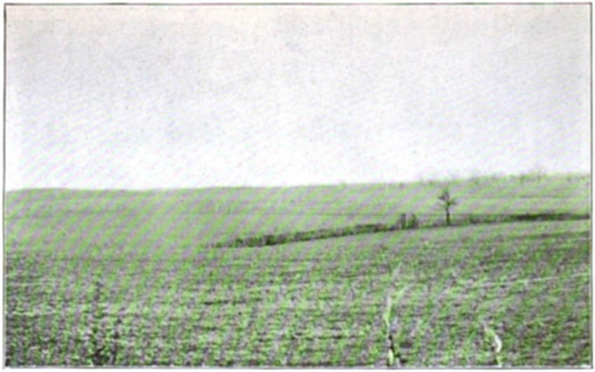
The valley of the Wabash, famed in song and story, and rich in Indian legend, is now filled with fields of corn and prosperous cities. At the close of the Revolution, the great stream swept through an unbroken wilderness of oak, maple and sycamore from its source to the old French settlement of Vincennes. Its bluffs, now adorned with the habitations of a peaceful people, then presented [Pg 35]the wild and rugged beauty of pristine days; its terraces, stretching back to the prairies of the north and west, were crowned with forests primaeval; while naked Miamis, Weas and Potawatomi in canoes of bark, rounded its graceful courses to the waters of the Ohio.
Miami Indian Photo Gallery
For one who has ridden over the hills to the west and south of Purdue University, and viewed the gorgeous panorama of the Wea plain, or who has glimpsed in the perspective the wooded hills of Warren and Vermilion from the bluffs on the eastern side of the river, it is not hard to understand why the red man loved the Wabash. An observer who saw it in the early part of the last century pens this picture: "Its green banks were lined with the richest verdure. Wild flowers intermingled with the tall grass that nodded in the passing breeze. Nature seemed clothed in her bridal robe. Blossoms of the wild plum, hawthorn and red-bud, made the air redolent." Speaking of the summer, he says: "The wide, fertile bottom lands of the Wabash, in many places presented one continuous orchard of wild plum and crab-apple bushes, over-spread with arbors of the different varieties of the woods grape, wild hops and honeysuckle, fantastically wreathed together. One bush, or cluster of bushes, often presenting the crimson plum, the yellow crab-apple, the blue luscious grape, festoons of matured wild hops, mingled with the red berries of the clambering sweet-briar, that bound them all lovingly together."
Through all this wild and luxurious wilderness of vines, grasses and flowers flitted the honey bee, called by the Indians, "the white man's fly," storing his golden [Pg 36]burden in the hollow trunks of the trees. While on the march from Vincennes, in the last days of September, 1811, Captain Spier Spencer's Yellow Jackets found three bee trees in an hour and spent the evening in cutting them down. They were rewarded by a find of ten gallons of rich honey.
The great river itself now passed between high precipitous bluffs, crowned with oak, sugar, walnut and hickory, or swept out with long graceful curves into the lowlands and bottoms, receiving at frequent intervals the waters of clear, sparkling springs and brooks that leaped down from rocky gorges and hillsides, or being joined by the currents of some creek or inlet that in its turn swept back through forest, glade and glen to sun-lit groves and meadows of blue grass.
Everywhere the waters of the great stream were clear and pellucid. The plow-share of civilization had not as yet turned up the earth, nor the filth and sewerage of cities been discharged into the current. In places the gravelly bottom could be seen at a great depth and the forms of fishes of great size reposing at ease. "Schools of fishes—salmon, bass, red-horse and pike—swam close along the shore, catching at the bottoms of the red-bud and plum that floated on the surface of the water, which was so clear that myriads of the finny tribe could be seen darting hither and thither amidst the limpid element, turning up their silvery sides as they sped out into deeper water."
The whole valley of the Wabash abounded with deer, and their tiny hoofs wrought foot paths through every [Pg 37]hollow and glen. The small prairies bordered with shady groves, the patches of blue-grass, and the sweet waters of the springs, were great attractions. The banks of the Mississinewa, Wild Cat, Pine Creek, Vermilion, and other tributaries, were formerly noted hunting grounds. George Croghan, who described the Wabash as running through "one of the finest countries in the world," mentions the deer as existing in great numbers. On the march of General Harrison's men to Tippecanoe, the killing of deer was an every day occurrence, and at times the frightened animals passed directly in front of the line of march. Raccoons were also very plentiful. On a fur trading expedition conducted by a French trader named La Fountaine, from the old Miamitown (Fort Wayne), in the winter of 1789-90, he succeeded in picking up about eighty deer skins and about five hundred raccoon skins in less than thirty days. He descended the Wabash and "turned into the woods" toward the White River, there bartering with the Indians for their peltries.
As to wild game, the whole valley was abundantly supplied. In the spring time, great numbers of wild ducks, geese and brant were found in all the ponds and marshes; in the woody ground the wild turkey, the pheasant and the quail. At times, the sun was actually darkened by the flight of wild pigeons, while the prairie chicken was found in all the open tracts and grass lands.
The bottom lands of this river, were noted for their fertility. The annual inundations always left a rich deposit of silt. This silt produced excellent maize, potatoes, beans, pumpkins, squashes, cucumbers and melons. These, [Pg 38]according to Heckewelder, were important items of the Indian food supply.
To the Indian we are indebted for ash-cake, hoecake, succotash, samp, hominy and many other productions made from the Indian maize. The Miamis of the Wabash, with a favorable climate and a superior soil, produced a famous corn with a finer skin and "a meal much whiter" than that raised by other tribes. How far the cultivation of this cereal had progressed is not now fully appreciated. In the expedition of General James Wilkinson against the Wabash Indians in 1791, he is said to have destroyed over two hundred acres of corn in the milk at Kenapacomaqua, or the Eel river towns, alone, and to have cut down a total of four hundred and thirty acres of corn in the whole campaign. In General Harmar's campaign against Miamitown in the year 1790, nearly twenty thousand bushels of corn in the ear were destroyed. On the next day after the battle of Tippecanoe the dragoons of Harrison's army set fire to the Prophets Town, and burned it to the ground. Judge Isaac Naylor says that they found there large quantities of corn, beans and peas, and General John Tipton relates that the commissary loaded six wagons with corn and "Burnt what was estimated at two thousand bushel."
Of the many other natural advantages of this great valley, much might be written. Wheat and tobacco, the latter of a fine grade, were growing at Vincennes in 1765, when Croghan passed through there. Wild hemp was abundant in the lowlands. The delicious pecan flourished, and walnuts, hazelnuts and hickory nuts were [Pg 39]found in great plenty. The sugar maple existed everywhere, and the Indians, who were the original sugar makers of the world, made large quantities of this toothsome article. In addition to this the whole valley was filled with wild fruits and berries, such as blackberries, dewberries, raspberries, gooseberries, and the luscious wild strawberry, that grew everywhere in the open spaces and far out on the bordering prairies.
This sketch of the Wabash and its wonderful possibilities may not be more aptly closed, than by appending hereto the description of Thomas Hutchins, the first geographer of the United States. It appears in his "Topographical Description," and mention is made of the connection of the Wabash by a portage with the waters of Lake Erie; the value of the fur trade at Ouiatenon and Vincennes, and many other points of vital interest.
"The Wabash, is a beautiful river, with high and upright banks, less subject to overflow than any other river (the Ohio excepted) in this part of America. It discharges itself into the Ohio, one thousand twenty-two miles below Fort Pitt, in latitude thirty-seven degrees, forty-one minutes. At its mouth, it is two hundred and seventy yards wide; is navigable to Ouiatenon (four hundred twelve miles) in the spring, summer, and autumn with bateaux and barges, drawing about three feet of water. From thence, on account of a rocky bottom, and shoal water, large canoes are chiefly employed, except when the river is swelled with rains, at which time, it may be ascended with boats, such as I have just described (197 miles further) to the Miami carrying place, which [Pg 40]is nine miles from the Miami village (Author's note: Miamitown or Fort Wayne), and this is situated on a river of the same name (Author's note: The Maumee was formerly called "Miami of the Lake"), that runs into the southwest part of Lake Erie. The stream of the Wabash, is generally gentle to Fort Ouiatenon, and nowhere obstructed with falls, but is by several rapids, both above and below that post, some of which are pretty considerable. There is also a part of the river for about three miles, and thirty miles from the carrying place, where the channel is so narrow, that it is necessary to make use of setting poles instead of oars. The land on this river is remarkably fertile, and several parts of it are natural meadows, of great extent, covered with fine long grass. The timber is large, and in such variety, that almost all the different kinds growing upon the Ohio, and its branches (But with a greater proportion of black and white mulberry trees), may be found. A silver mine has been discovered about 28 miles above Ouiatenon, on the northern side of the Wabash, and probably others may be found hereafter. The Wabash abounds with salt springs, and any quantity of salt may be made from them, in the manner now done at the Saline in the Illinois country. The hills are replenished with the best coal, and there is plenty of lime and freestone, blue, yellow and white clay, for glass works and pottery."
The Wabash River at Merom Bluff
The Wabash River at Merom Bluff, Sullivan County, Indiana, LaMotte Prairie beyondToList
"Two French settlements are established on the Wabash, called Post Vincent and Ouiatenon; the first is 150 miles, and the other 262 miles from its mouth. The former is on the eastern side of the river, and consists of [Pg 41]sixty settlers and their families. They raise corn, wheat and tobacco of an extraordinary good quality, superior, it is said, to that produced in Virginia. They have a fine breed of horses (Brought originally by the Indians from the Spanish settlements on the western side of the Mississippi), and large flocks of swine and black cattle. The settlers deal with the natives for furs and deer skins, to the amount of about 5,000 pounds annually. Hemp of good texture grows spontaneously in the lowlands of the Wabash, as do grapes in the greatest abundance, having a black, thin skin, and of which the inhabitants in the autumn, make a sufficient quantity (for their own consumption) of well-tasted red wine. Hops, large and good, are found in many places, and the lands are particularly adapted to the culture of rice. All European fruits, apples, peaches, pears, cherries, currants, gooseberries, melons, etc., thrive well both here and in the country bordering on the river Ohio."
"Ouiatenon (Author's note: Just below Lafayette), is a small stockaded fort on the western side of the Wabash, in which about a dozen families reside. The neighboring Indians are the Kickapoos, Musquitons, Pyankeshaws, and a principal part of the Ouiatenons. The whole of these tribes consists, it is supposed, of about one thousand warriors. The fertility of soil, and the diversity of timber in this country, are the same as in the vicinity of Post Vincent. The annual amount of skins and furs obtained at Ouiatenon is about 8,000 pounds. By the river Wabash, the inhabitants of Detroit move to the southern parts of Ohio, and the Illinois country. Their [Pg 42]route is by the Miami river (Maumee) to a carrying place (Author's note: Miamitown or Fort Wayne), which, as before stated, is nine miles to the Wabash, when this river is raised with freshies; but at other seasons, the distance is from eighteen to thirty miles, including the portage. The whole of the latter is through a level country. Carts are usually employed in transporting boats and merchandise, from the Miami to the Wabash river."
No less wonderful was the valley of the Maumee, directly on the great trade route between the Wabash and the post of Detroit. Croghan, who was a good judge of land, and made careful observations, found the Ottawas and Wyandots here in 1765, the land of great richness, and game very plentiful. It was a region greatly beloved by the Indian tribes, and the scene after the revolution, of many grand councils of the northwestern confederacy. In a letter of General Anthony Wayne, written in 1794, he asserts that: "The margins of these beautiful rivers, the Miamis of the Lake (Maumee), and the Au Glaize (A southern tributary), appear like one continued village for a number of miles, both above and below this place, Grand Glaize, nor have I ever before beheld such immense fields of corn in any part of America, from Canada to Florida."
After General Wayne's army had defeated the Indians at the battle of Fallen Timbers on this river in 1794, they spent many days after that conflict in destroying the fields of grain. One who marched with the army, in August of the above year, describes Indian corn fields extending for four or five miles along the Au Glaize, and [Pg 43]estimated that there were one thousand acres of growing corn. The whole valley of the Maumee from its mouth to Fort Wayne, is described as being full of immense corn fields, large vegetable patches, and old apple trees, and it is related that Wayne's army, while constructing Fort Defiance for a period of eight days, "obtained their bread and vegetables from the corn fields and potato patches surrounding the fort."
Is it any wonder that along these wonderful basins should be located the seats of power of the Miami Indians, the leaders of the western confederacy that opposed the claims of the United States to the lands north of the Ohio; that from the close of the Revolutionary war until Wayne's victory in 1794, the principal contest was over the possession of the Miami village, now Fort Wayne, which controlled the trade in both the Wabash and the Maumee Valleys, and that President George Washington, consummate strategist that he was, foresaw at once in 1789, the first year of his presidency, that the possession of the great carrying place at Miamitown would probably command the whole northwest and put an end to the Indian wars?

Land of the Miami Indians Illustrated


THE LAND OF THE MIAMIS


By Elmore Barce

THE PRAIRIE AND THE BUFFALO

The buffalo as the main food supply of the Indians.


To describe all the wonders in the interior of the northwest would be a serious, if not an impossible task. The Grand Prairie, however, stands alone. It was one of the marvels of creation, resembling the ocean as nothing else did, making men who saw, never forget.
On Sunday, the third day of November, 1811, General Harrison's army, with scouts in front, and wagons lumbering along between the flanks, crossed the Big Vermilion river, in Vermilion County, Indiana, traversed Sand Prairie and the woods to the north of it, and in the afternoon of the same day caught their first glimpse of the Grand Prairie, in Warren County, then wet with the cold November rains. That night they camped in Round Grove, near the present town of Sloan, marched eighteen miles across the prairie the next day, and camped on the east bank of Pine creek, just north of the old site of Brier's Mills. To the most of them, the sight must have been both novel and grand; if they could have known then that the vast undulating plain before them stretched westward in unbroken grandeur, a distance of two [Pg 21]hundred and fifty miles to the Mississippi river at Quincy; that these vast possessions in a few short years would pass from the control of the savage tribes that roamed over them, and would become the future great granaries of the world, producing enough cereals to feed an empire, what must have been their thoughts?
The magnitude of this great plain, now teeming with thousands of homes and farms, is seldom realized. Draw a straight line west from old Fort Vincennes to the Mississippi, and practically all north of it, to the Wisconsin line, is the Grand Prairie. "Westward of the Wabash, except occasional tracts of timbered lands in northern Indiana and fringes of forest growth along the intervening water courses, the prairies stretch westward continuously across Indiana, and the whole of Illinois to the Mississippi. Taking the line of the Wabash railway, which crosses Illinois in its greatest breadth, and beginning in Indiana, where the railway leaves the timber, west of the Wabash near Marshfield (in Warren County), the prairie extends to Quincy, a distance of more than two hundred and fifty miles, and its continuity the entire way is only broken by four strips of timber along four streams running at right angles with the route of the railway, namely, the timber on the Vermilion river between Danville and the Indiana state line; the Sangamon, seventy miles west of Danville, near Decatur; the Sangamon again a few miles east of Springfield, and the Illinois river at Meredosia, and all the timber at the crossing of these several streams, if put together, would not aggregate fifteen miles, against the two hundred and fifty miles [Pg 22]of prairie. Taking a north and south direction and parallel with the drainage of the rivers, one could start near Ashley, on the Illinois Central railway, in Washington county, and going northward, nearly on an air line, keeping on the divide between Kaskaskia and Little Wabash, the Sangamon and the Vermilion, the Iroquois and the Vermilion of the Illinois, crossing the latter stream between the mouths of the Fox and DuPage, and travel through to the state of Wisconsin, a distance of nearly three hundred miles, without encountering five miles of timber during the whole journey."
All that portion of Indiana lying north and west of the Wabash, is essentially a part of the Grand Prairie. "Of the twenty-seven counties in Indiana, lying wholly or partially west and north of the Wabash, twelve are prairie, seven are mixed prairies, barrens and timber, the barrens and prairie predominating. In five, the barrens, with the prairies, are nearly equal to the timber, while only three of the counties can be characterized as heavily timbered. And wherever timber does occur in these twenty-seven counties, it is found in localities favorable to its protection against the ravages of fire, by the proximity of intervening lakes, marshes or watercourses." On the Indiana side, the most pronounced of the tracts of prairie occur in western Warren, Benton, southern and central Newton, southern Jasper, and western White and Tippecanoe. Benton was originally covered with a great pampas of blue-stem, high as a horse's head, interspersed here and there with swamps of willows and bull grass, while only narrow fringes of timber [Pg 23]along the creeks, and some five or six groves of timber and woodland, widely scattered, served as land marks to the early traveler.
Those who early observed and explored the grassy savannas of Indiana and Illinois, always maintained that they were kept denuded of trees and forests by the action of the great prairie fires. Among those who have supported this theory are the Hon. James Hall, author of "The West," published in Cincinnati in 1848; the Hon. John Reynolds, former governor of the state of Illinois, and the Hon. John D. Caton, a late judge of the Supreme Court of Illinois. Caton's observations on this subject are so interesting and ingenious that we cannot refrain from making the following quotation:
"The cause of the absence of trees on the upland prairies is the problem most important to the agricultural interests of our state, and it is the inquiry which alone I propose to consider, but cannot resist the remark that wherever we do find timber throughout the broad field of prairie, it is always in or near the humid portions of it, as along the margins of streams, or upon or near the springy uplands. Many most luxurious growths are found in the highest portions of the uplands, but always in the neighborhood of water. For a remarkable example, I may refer to the great chain of groves extending from and including the Au Sable grove on the east and Holderman's grove on the west, in Kendall county, occupying the high divide between the waters of the Illinois and the Fox rivers. In and around all the groves flowing springs abound, and some of them are separated by marshes, to[Pg 24]the borders of which the great trees approach, as if the forests were ready to seize upon each yard of ground as soon as it is elevated above the swamps. Indeed, all our groves seem to be located where the water is so disposed as to protect them, to a greater or less extent, from the prairie fire, although not so situated as to irrigate them. If the head waters of the streams on the prairies are most frequently without timber, as soon as they have attained sufficient volume to impede the progress of fires, with very few exceptions, we find forests on their borders, becoming broader and more vigorous as the magnitude of the streams increase. It is manifest that the lands located on the borders of streams which the fire cannot pass, are only exposed to one-half the fires to which they would be exposed, but for such protection. This tends to show, at least, that if but one-half the fires that have occurred had been kindled, the arboraceous growth could have withstood their destructive influences, and the whole surface of what is now prairie would be forest. Another confirmatory fact, patent to all observers, is, that the prevailing winds upon the prairies, especially in the autumn, are from the west, and these give direction to the fires. Consequently, the lands on the westerly sides of the streams are the most exposed to the fires, and, as might be expected, we find much the most timber on the easterly sides of the streams."
A Section of the Grand Prairie in Benton County
A Section of the Grand Prairie in Benton County, Indiana, which extends west to Peoria, Illinois.
Miami Indian Photo Gallery
Local observation in Benton County, Indiana, which is purely prairie throughout, would seem to confirm the judge's view. Parish grove, on the old Chicago road, was filled with springs, and a rather large spring on the [Pg 25]west side of the grove, supplied water for the horses of the emigrants and travelers who took this route to the northwest in the early 40's. Besides this, the grove was situated on rather high uplands, where the growth of grass would be much shorter than on the adjoining plain. It is probable that this spring on the west side, and the springy nature of the highlands back of it, kept the ground moist and the vegetation green, and these facts, coupled with the fact that the grass as it approached the uplands, would grow shorter, probably retarded and checked the prairie fires from the southwest, and gave rise to the wonderfully diversified and luxuriant growth of trees that was the wonder of the early settler. Sugar grove, seven miles to the northwest of Parish grove, and a stopping place on the old Chicago road, lay mostly within the point or headland caused by the juncture of Sugar Creek from the northeast, and Mud Creek from the southeast. Scarcely a tree is on the southwestern bank of Mud creek, but where it widens on the south side of the grove, it protected the growth of the forest on the northern side. Turkey Foot grove, east and south of Earl Park, formerly had a lake and depression both on the south and west sides of it. Hickory Grove, just west of Fowler, in the early days, had a lake or pond on the south and west. The timber that skirted the banks of Pine creek, was heaviest on the eastern side. The headwaters of Sugar, Pine and Mud creeks, being small and narrow, were entirely devoid of trees on their banks, but as they flowed on and acquired strength and volume, a skirt of forest appeared.
[Pg 26]The Grand Prairie, the home of the ancient Illinois tribe, the Sacs and Foxes, the Kickapoos, and the prairie Potawatomi, was also the home of the buffalo, or wild cow of America. No story either of the northwest or its Indian tribes would be complete without mention of the bison. Think of the sight that Brigadier General Harmar saw on the early prairies of Illinois, when marching from Vincennes to Kaskaskia, in November 1787! With him the Miami chief, Pachan (Pecan) and a comrade, killing wild game for the soldiers; before him stretching the vastness of the prairie, "like the ocean, as far as the eye can see, the view terminated by the horizon;" here and there the herds of deer and buffalo far in the distance.
For centuries before the advent of the white man the buffalo herds roamed the plain. The savage, with no weapon in his hands, save rudely chipped pieces of stone, was unable to reduce their numbers. With the coming of firearms and the rifle the buffalo passed rapidly away.
In the seventeenth and the early part of the eighteenth centuries the buffalo ranged as far east as western New York and Pennsylvania, and as far south as Virginia, the Carolinas and Georgia. Father Marquette, in his explorations, declared that the prairies along the Illinois river were "covered with buffalos." Father Hennepin, in writing of northern Illinois, between Chicago and the Illinois river, asserted that "There must be an innumerable quantity of wild bulls in this country, since the earth is covered with their horns. * * * They follow one another, so that you may see a drove of them [Pg 27]for about a league together. Their ways are beaten, as are our great roads, and no herb grows therein."
Of the presence of large numbers of buffalo, that resorted to the salty licks of Kentucky, we have frequent mention by both Humphrey Marshall and Mann Butler, the early historians of that state. In the year 1755, Colonel James Smith mentions the killing of several buffalo by the Indians at a lick in Ohio, somewhere between the Muskingum, the Ohio and the Scioto. At this lick the Indians made about a half bushel of salt in their brass kettles. He asserts that about this lick there were clear, open woods, and that there were great roads leading to the same, made by the buffalo, that appeared like wagon roads. The wild cattle had evidently been attracted thither by the mineral salts in the water. In the early morning of June 13, 1765, George Croghan, an Indian agent sent out by William Johnson, of New York, to report to the English government conditions in the west, coming into view of one of the fine large meadows bordering on the western banks of the Wabash, saw in the distance herds of buffalo eating the grass, and describes the land as filled with buffalo, deer and bears in "great plenty." On the 18th and 19th of the same month, he traveled through what he terms as a "prodigious large meadow, called the Pyankeshaw's Hunting Ground," and describes it as well watered and full of buffalo, deer, bears, and all kinds of wild game. He was still in the lower Wabash region. On the 20th and 21st of June he was traveling north along the Wabash in the vicinity of the Vermilion river in Vermilion county, and states that [Pg 28]game existed plentifully, and that one could kill in a half hour as much as was needed. He spoke, evidently, of the large variety of game before mentioned. The whole of the prairie of Illinois, filled with an abundant growth of the richest grasses, and all the savannas north of the Wabash in Indiana, that really constituted an extension of the Grand Prairie, were particularly suited to the range of the wild herds, and were the last grounds deserted by them previous to their withdrawal west, and across the Mississippi.
The economical value of the herds of buffalo to the Indian tribes of the northwest may be gathered from the uses to which they were afterwards put by the tribes of the western plains. "The body of the buffalo yielded fresh meat, of which thousands of tons were consumed; dried meat, prepared in summer for winter use; pemmican (also prepared in summer) of meat, fat and berries; tallow, made up into large balls or sacks, and kept in store; marrow, preserved in bladders; and tongues, dried and smoked, and eaten as a delicacy. The skin of the buffalo yielded a robe, dressed with the hair on, for clothing and bedding; a hide, dressed without the hair, which made a tepee cover, when a number were sewn together; boats, when sewn together in a green state, over a wooden frame work; shields, from the thickest portions, as rawhide; clothing of many kinds; bags for use in traveling; coffins, or winding sheets for the dead, etc. Other portions utilized were sinews, which furnished fibre for ropes, thread, bowstrings, snow shoe webs, etc.; hair, which was sometimes made into belts [Pg 29]and ornaments; "buffalo chips," which formed a valuable and highly prized fuel; bones, from which many articles of use and ornament were made; horns, which were made into spoons, drinking vessels, etc." The Rev. John Heckewelder, in speaking of the skill of the Delawares of Ohio, in dressing and curing buffalo hides, in the latter part of the eighteenth century, says that they cured them so that they became quite soft and supple, and so that they would last for many years without wearing out.
All at once, and near the beginning of the last decade of the eighteenth century, the buffalo herds east of the Mississippi, suddenly disappeared. George Wilson, in his history of Dubois County, Indiana, says that, "toward the close of the eighteenth century a very cold winter, continuing several months, froze all vegetable growth, starved the noble animals, and the herds never regained their loss." This statement is borne out by the testimony of the famous Potawatomi chieftain Shaubena, of northern Illinois, who says that the trade in buffalo robes east of the Mississippi ceased in about the year 1790; that when a youth he joined in the chase of buffalos on the prairies, but while he was still young, they all disappeared from the country. "A big snow, about five feet deep, fell, and froze so hard on the top that people walked on it, causing the buffalo to perish by starvation. Next spring a few buffalo, poor and haggard in appearance, were seen going westward, and as they approached the carcasses of dead ones, lying here and there on the prairies, they would stop, commence pawing and lowing, then start off again in a lope for the west." It is true [Pg 30]that Brigadier-General Josiah Harmar, in marching from Vincennes to Kaskaskia, in 1787, gives a striking account of the early prairies, "like the ocean, as far as the eye can see, the view terminated by the horizon," and describes the country as excellent for grazing, and abounding with deer and buffalo. Pachan, or Pecan, a famous Miami chieftain from Miamitown, and an Indian comrade, supplied the military party with buffalo and deer meat on the march out, and on the return. Notwithstanding these facts, the story of the terrible winter and the deep snow as told by Shaubena seems authentic, and while scattered remnants of the great herds may still have existed for some time afterward, the great droves stretching "for above a league together," were seen no more.
The great snowfall was the culminating tragedy. In order to secure whiskey and brandy the horse tribes of the prairies had slaughtered thousands, and bartered away their robes and hides. What distinguishes the savage from civilized man is, that the savage takes no heed of the morrow. To satisfy his present passions and appetites he will sacrifice every hope of the future. He no longer cures the skins and clothes his nakedness. He thinks no longer of husbanding his supply of meat and game. He robs the plain, and despoils every stream and river, and then becomes a drunken beggar in the frontier towns, crying for alms. The same thing that happened on the plains of Illinois at the close of eighteenth, took place on the plains west of the Mississippi in the last half of the nineteenth century. The giant herds melted away before the remorseless killings of the still hunters [Pg 31]and savages, who threw away a meat supply worth millions of dollars in a mad chase for gain and plunder, and no one took a more prominent part in that killing than the Indian himself.
"When the snow fall was unusually heavy," says William T. Hornaday, "and lay for a long time on the ground, the buffalos fast for days together, and sometimes even weeks. If a warm day came, and thawed the upper surface of the snow, sufficiently for succeeding cold to freeze it into a crust, the outlook for the bison began to be serious. A man can travel over a crust through which the hoofs of a ponderous bison cut like chisels and leave him floundering belly-deep. It was at such times that the Indians hunted him on snow-shoes, and drove their spears into his vitals as he wallowed helplessly in the drifts. Then the wolves grew fat upon the victims which they, also, slaughtered without effort." This is probably an accurate description of what took place east of the Mississippi river about the year 1790, and left the bones of the herds to bleach on the prairies.
However the facts may be, it is certain that at the opening of the nineteenth century the buffalo were practically extinguished in the territory of the northwest. A few scattered animals may have remained here and there upon the prairies, but the old herds, whose progenitors were seen by Croghan were forever gone. In the month of December, 1799, Judge Jacob Burnet was traveling overland on horseback from Cincinnati to Vincennes on professional business, and while at some point north and west of the falls of the Ohio, he and his companions [Pg 32]surprised a small herd of eight or ten buffalos, that were seeking shelter behind the top of a fallen beech tree on the line of an old "trace," during a snow storm. This is one of the last accounts given of any buffalos in Indiana. On August 18th and August 27th, 1804, Governor William Henry Harrison, as Indian agent for the United States government, bought a large tract of land in southern Indiana, between the Wabash and the Ohio rivers, from the Delaware and Piankeshaw tribes. The right to make this purchase was disputed by Captain William Wells, the Indian agent at Fort Wayne, and by the Little Turtle, claiming to represent the Miamis, and it was claimed among other things, that the lands bought were frequented as a hunting ground by both the Miamis and Potawatomi, and that they went there to hunt buffalo. The truth of this statement was denied by Governor Harrison, who said that not an animal of that kind "had been seen within that tract for several years."
A typical buffalo wallow
Photo by Heaton
A typical buffalo wallow on the Donaldson farm in Benton County, Indiana.ToList
Traces of the old buffalo wallows are occasionally met with, even to this day. The great animals "rolled successively in the same hole, and each carried away a coat of mud," which, baking in the sun, served to protect them against the great swarm of flies, gnats and insects that infested the marshes and prairies of that early time. One of these wallows, in a perfect state of preservation, exists in the northwest quarter of section thirty, in township twenty-five north, range six west, in Benton County, Indiana. It is several yards in diameter, hollowed out to a depth of four or five feet, and its periphery is almost an exact circle. It is situated on a rather high, springy [Pg 33]knoll, commanding a view of the surrounding plain for several miles. A great number of Indian arrow heads have been picked up in the immediate vicinity, showing that the Indiana had previously resorted thither in search of game.